Software GeoMax X-Pad Office Fusion
Top Features
-
Have TPS surveys, GPS surveys, levelling, laser scanning sessions linked together and see it all together.
-
Load, calculate, display and manage data from total stations, GNSS, digital levels and laser scanners.
Variants
Variant
Technical Data
| Product Number (PID) | 29xxxxxx |
|---|
Highlights at a Glance
-
X-PAD Office ensures productivity in the office and offers perfect integration between measuring devices.
-
Versatile import / export possibilities
-
Different data formats for laser scanner point clouds
Description
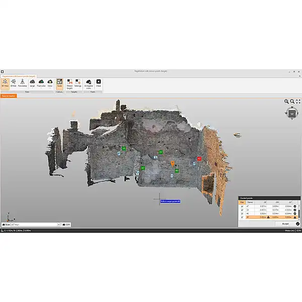
X-PAD Office Fusion is a desktop software that integrates geospatial data from TPS, GNSS, scanners and other sensors in a single environment.
Unlike other software solutions on the market, X-PAD Fusion provides a software solution that manages measurements, points, drawings, surfaces, point clouds and other data types on ONE platform in a simple and intuitive way. We help you get started right away with our interactive tutorials that guide you through the entire workflow to make it even easier to use
Unlike other software solutions on the market, X-PAD Fusion provides a software solution that manages measurements, points, drawings, surfaces, point clouds and other data types on ONE platform in a simple and intuitive way. We help you get started right away with our interactive tutorials that guide you through the entire workflow to make it even easier to use